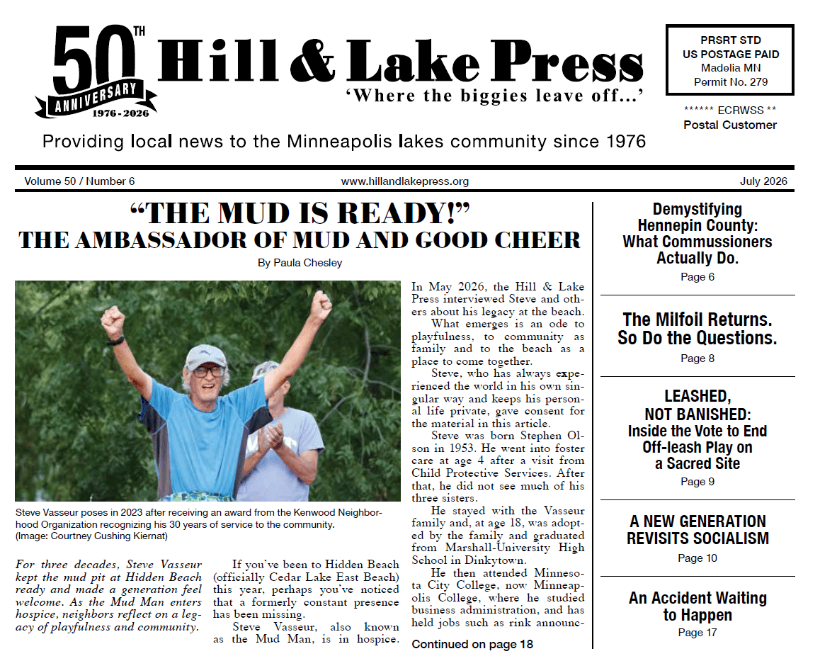
“At some point we will have to decide what to do with the excess land in the Kenilworth Corridor.” When a Hennepin County staffer uttered those words at a meeting back in 1996, my ears instantly perked up. “What?” I asked. “What did you say?”
He explained that after completion of the Southwest Light Rail Transit project, there would be surplus land in the corridor not needed for the Southwest Light Rail right-of-way.
He indicated that Hennepin County would have to determine what to do with this property. It was the first time I heard of the “remnant land” issue.
This story really begins 40 years ago.
In 1984 Hennepin County, through its Hennepin County Regional Railroad Authority (HCRRA), purchased a large parcel of land in the Kenilworth Corridor from the Chicago & North Western Railway. (The railroad had previously gobbled up the historic Minneapolis & St. Louis Railway (M & StL), which had dominated the Kenilworth Corridor for almost a century.)
HCCRA locked down the land for use as a possible route for a future Southwest light rail. Although light rail was only a distant vision in 1984, HCCRA was thinking ahead.
Separately, Minneapolis in the 1990s embarked upon an ambitious plan to construct a non-motorized trail system
The city viewed the Kenilworth Corridor as an ideal trail link between the Cedar Lake Regional Trail (1995) and the projected Midtown Greenway (2000). But there was a catch. HCCRA had purchased the corridor for light rail use and had concerns about putting a trail through its future LRT right-of-way.
After much discussion, the sides agreed there’d be room for both trail and rail and HCCRA green-lighted the project.
So in 1996 the city convened a meeting of Kenilworth Trail Citizens’ Advisory Committee. I attended the meeting as a representative of the Cedar Lake Park Association.
Previously CLPA had been a driving force in the purchase of a 48-acre abandoned rail yard north of Cedar Lake, its incorporation into Cedar Lake Park, and in the subsequent construction of the Cedar Lake Regional Trail.
CLPA hoped that there might be land in the Kenilworth Corridor that could also be incorporated into Cedar Lake Park.
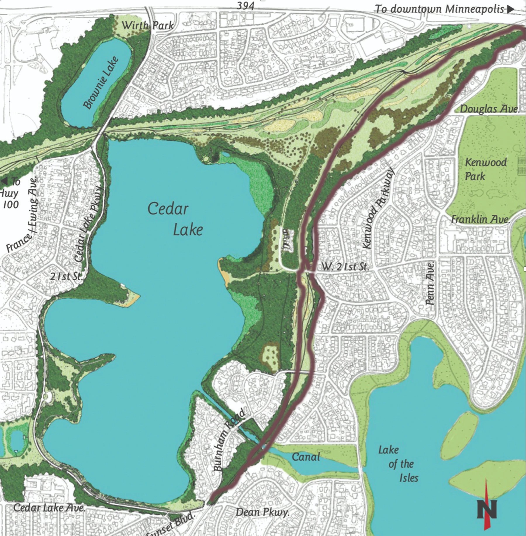
Describing the Remnant Land
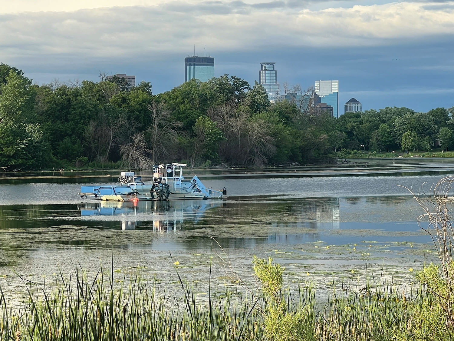
The property (see map above) can be broken into two distinct wedges of land.
The 38-acre northern section lies just below the Kenwood Bluffs, from I-394 to 21st Street. This site had once been the hub of M & StL’s rail empire with over 20 major shops blanketing the area. When HCRRA purchased the land, it reduced the M & StL’s vacant buildings to rubble.
A scrub forest soon grew up among the debris. In its present state, it is doubtful that this area would be suitable for development.
The 10-acre southern portion runs from 21st Street to Cedar Lake Parkway. Much of this land was once underwater, a part of the old Cedar Lake East Bay.
About 150 years ago, the M & StL began to fill in the bay and then laid tracks over it. After HCRAA bought the property from M & StL’s successor, all but one of the tracks were removed. The unburdened land grew into lovely little prairie — at least until recently, when the area became a construction zone.
After construction, much of this area undoubtedly could be suitable for development. Or it could be made into a park.
The Coming of Light Rail
Over 30 years after HCCRA initially bought the Kenilworth Corridor, its vision became a reality. In 2016 the Metropolitan Council chose the corridor as the preferred route for Southwest light rail. To facilitate construction, HCCRA transferred ownership of the entire Kenilworth Corridor to the Metropolitan Council.
Not long after, the Met Council and the City of Minneapolis completed a Memorandum of Understanding. Included in the MOU was language regarding the remnant land: “The Council intends that any property located in the Kenilworth Corridor that it may acquire from HCCRA that it will not actively use for either the Project or freight rail shall be conveyed to the Minneapolis Park and Recreation Board for use as parkland upon terms and conditions that are agreeable to both the Council and the Park Board.”
There was, however, a potential roadblock. Prior to transferring the corridor to the Met
Council, HCCRA passed resolution 14-HCRRA-0049R1. It stated, “… HCRRA understands that the MPRB has not officially requested such land, and in any event it is understood that such excess or remnant land does not include HCRRA-owned properties that are suitable for development, so HCRRA is making no commitments regarding “excess” or “remnant” land at this time … ” HCRRA’s resolution seemed at odds with the Met Council’s MOU with the city.
The issue resurfaced in 2023, when MPRB’s Cedar Lake-Lake of the Isles plan touched on the remnant land issue. The Park Board identified the section north of 21st Street as a “further acquisition site.” But it said nothing about the section south of 21st St. Was this an oversight? Or something else?
The Cedar Lake Park Association is troubled that the plan did not include the southern section of remnant land.
It started delving into relevant documents and asking questions about the remnant land’s ownership and possible disposition, especially of any land “suitable for development.”
CLPA contacted the various organizations for clarification. Although it took several months, CLPA’s tenacity paid off. Recently it received an email from Hennepin County Commissioner Marion Greene. After having her legal staff review all the pertinent agreements, she wrote, “Overall, I think these agreements give a significant amount of reassurance that any remnant parcels will stay in public hands.” It is heartening that Hennepin County/HCCRA now appears to embrace the view that even land in the corridor suitable for development should remain in public hands.