
If you have driven Franklin Avenue west of Hennepin Avenue and suddenly wondered which side of the road is yours, you are in good company.
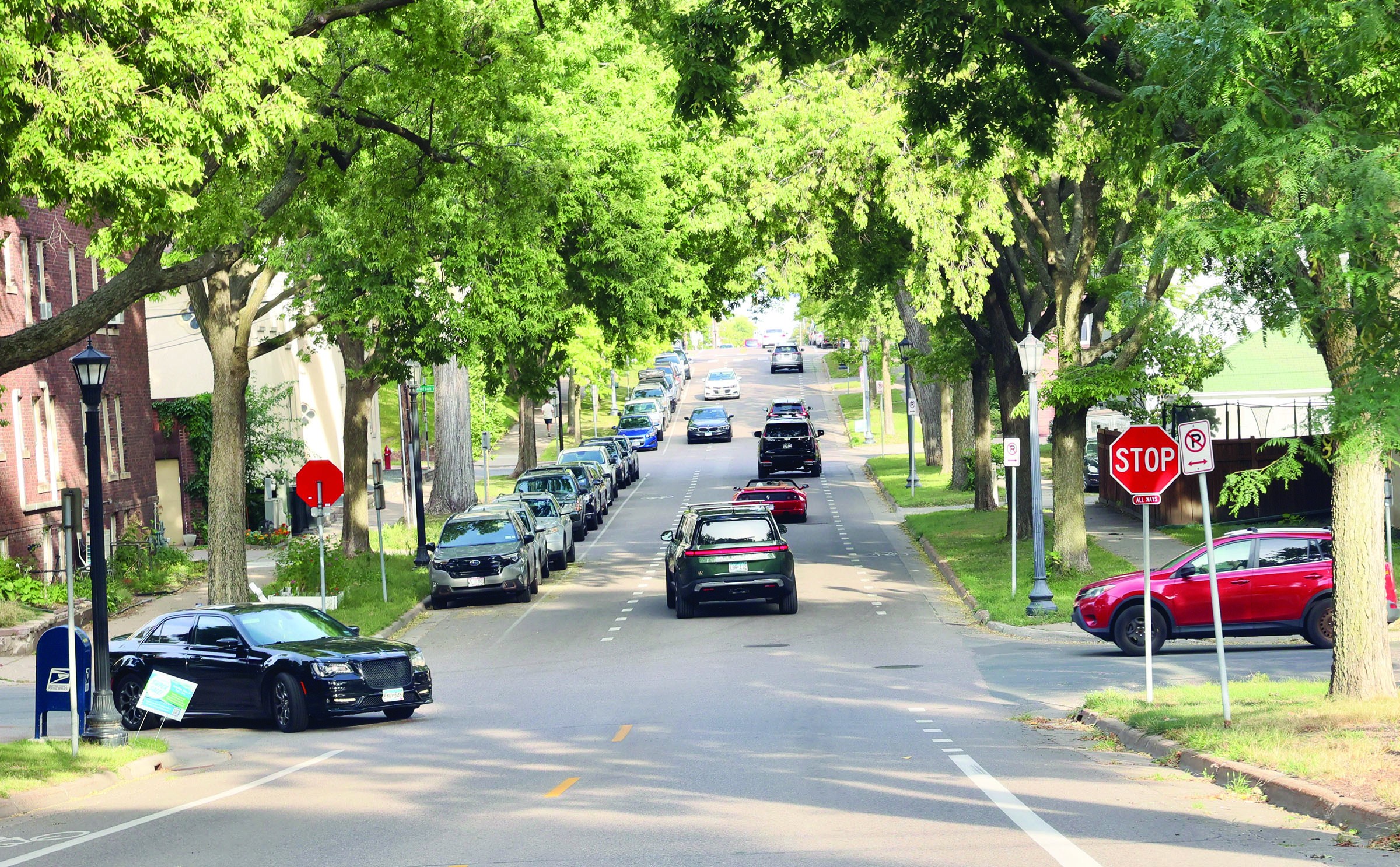
For several blocks, the yellow center line vanishes. Two dashed white lines run along the edges, and drivers going both directions are left sharing what looks like one wide lane, eyeing each other like strangers reaching for the same armrest.
Then, just as suddenly, the dashes end and Franklin goes back to ordinary bike lanes, as if nothing happened.
Congratulations. You have met an advisory bike lane.
What the Dashes Mean
The city’s Street Design Guide describes advisory bike lanes as “preferred but not exclusive operating space for people to bike along two-way roadways.” Translation: the dashed lanes along each edge belong to people on bikes, mostly. Cars going both directions share the middle.
“ Drivers often find it confusing. That is more or less the point.”
When two cars meet, one or both can ease into the bike lane to pass. The guide says advisory lanes “allow cars to merge into the bike lane area when approaching an oncoming vehicle,” and that drivers should do so carefully and only when no one is biking there.
A solid white line says stay out. A dashed one says you may cross, but mind your manners.
In practice: stay in the center, slow down when you meet an oncoming car, check the bike lane, move over only if it is empty, then glide back to the middle.
Why Franklin Got Them
These blocks of Franklin did not always allow parking. That changed during the Burch Steakhouse years, when the Burch, the Lowry, Lowry Hill Meats and other businesses had the area thriving and parking was genuinely hard to find. Street parking was extended farther down Franklin.
That created a puzzle: how do you fit parked cars, bike lanes and two directions of traffic onto the same stretch of pavement?
The answer was this hybrid, which runs for the several blocks where parking is allowed.
Drivers often find it confusing. That is more or less the point. The idea is that a driver who isn’t quite sure what is going on slows down and pays attention, which is exactly what you want on a street shared with people on bikes.
Does It Work?
Minneapolis tested advisory bike lanes in October 2011 on East 14th Street and Grant Street East, between Portland Avenue South and 11th Avenue South. A later evaluation found the share of people biking in the bike lane area rose from zero to 92%, and sidewalk riding fell from 10% to 3%. Bicycle crashes dropped from six in the three years before to two in the three years after. Typical speeds there barely changed.
Not everyone was a fan. “The lack of a yellow line is the confusing part,” one driver told evaluators. Still, the report concluded that the confusion did not show up in crash data or in how people actually drove. In other words, drivers were baffled and behaved anyway.
“ So if those stripes on Franklin feel like an experiment, technically, they are.”
Still an Experiment
According to the city’s guide, the Federal Highway Administration still considers advisory bike lanes an experimental treatment, so a city must get federal approval through a request to experiment before installing them. So if those stripes on Franklin feel like an experiment, technically, they are.
Craig Wilson is the editor of the Hill & Lake Press. He lives in Lowry Hill.