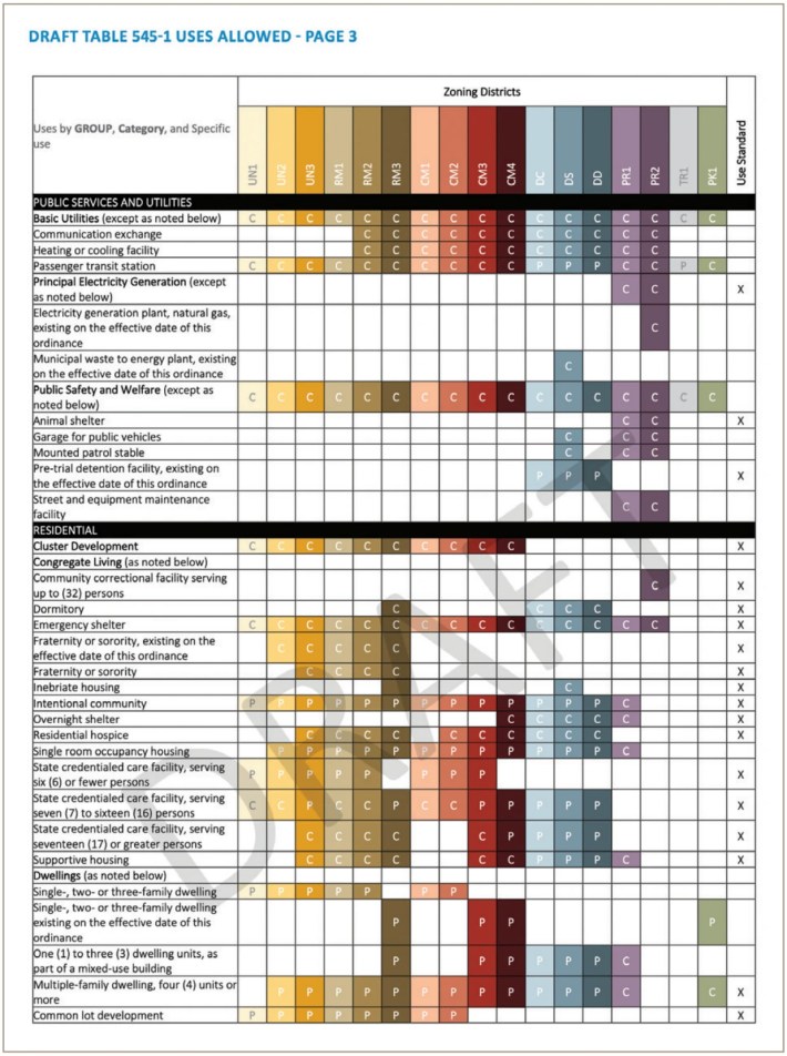
Readers will recall that area residents actively participated in the Minneapolis 2040 Comprehensive Plan process. The vigorous debate focused on eliminating single-family zoning in order to allow triplexes.
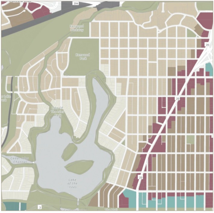
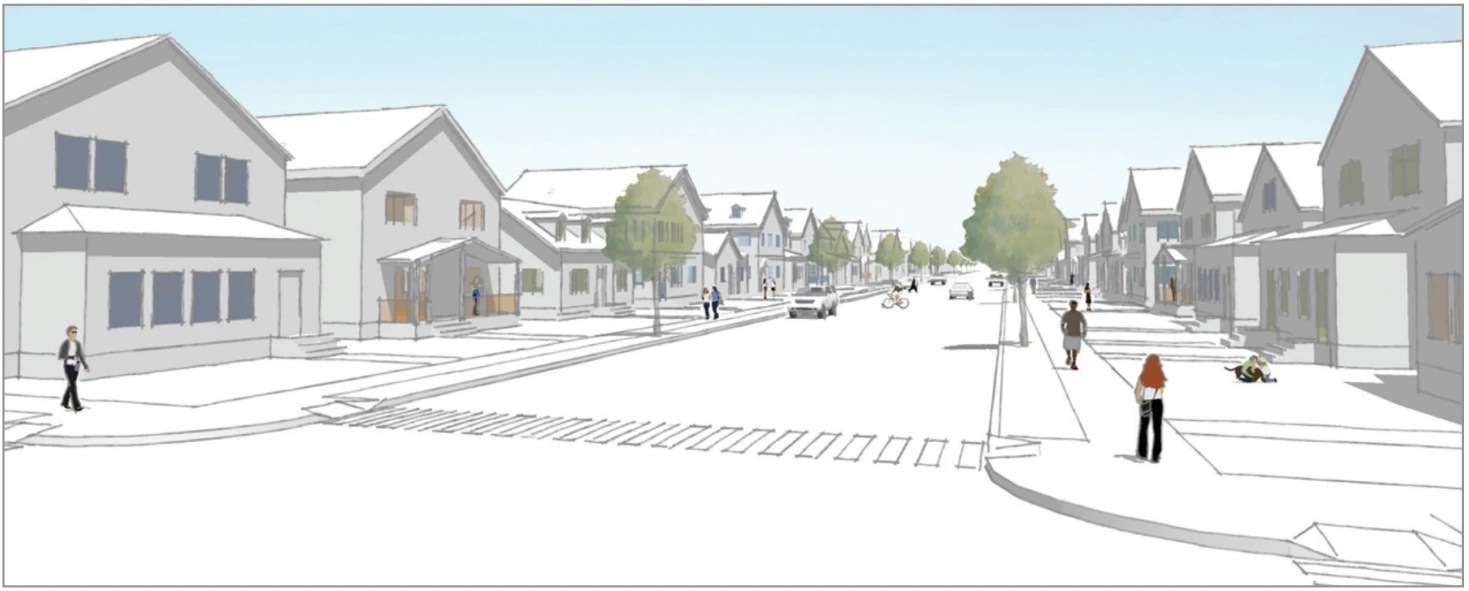
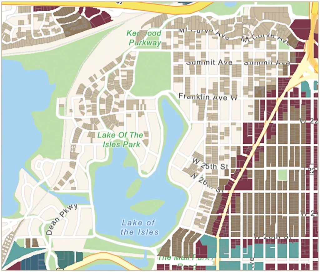
But the proposed zoning map the City released in January takes up zoning much further. It would permit fourplexes-and-up for roughly half the lots in Kenwood, Lowry Hill and East Isles.
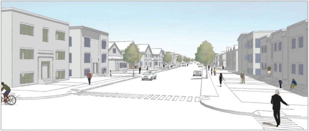
According to neighbor and architect Joan Soranno, these four unit-and-up structures could be as tall as 51 feet. That would include rooftop mechanical equipment, elevators and stairways — which the City’s visual rendering in Option B neglects to show.
Explaining the impact of the change on neighborhoods, Soranno says the introduction of triplexes in single-family zoning could help improve housing density throughout Minneapolis while not significantly changing the overall quality or scale of its neighborhoods. But, she continues, “With the proposed addition of higher density zoning closer to the downtown core (UN2/Interior 2), a large percentage of properties in Lowry Hill, East Isles and Kenwood will be eligible to build multi-family residences of 4 units or more. This zoning change will adversely affect the character and scale of some of the most historic and beloved neighborhoods in the Twin Cities.”
Indiscriminate planning is the opposite of planning.
We recognize that Minneapolis is facing a serious housing shortage, especially of affordable housing, and are not broadly opposed to high-density housing. Indeed, it’s the bedrock of many areas of the city, and is well represented in our area. In fact, in 2021, 57% of Lowry Hill residences are rental with a median monthly rent of $1,429; in Kenwood 41.5% are rental with median monthly rent of $1,465; and in East Isles 52.3% are rental with a median monthly rent of $1,382 (mncompass.org). These rates are by and large affordable: According to the City, households making less than 60% of Area Median Income (AMI) can afford a maximum rate of $1,233 for a studio/efficiency, $1,320 for a one-bedroom and $1,584 for a two-bedroom.
Our complaint is that the proposed zoning plan displays no understanding of the many layers that make cities great, good or mediocre. It treats the city as a featureless slate on which zoning is wielded as a blunt and indiscriminate instrument, implemented with little consideration of the historic and existing character of individual neighborhoods.
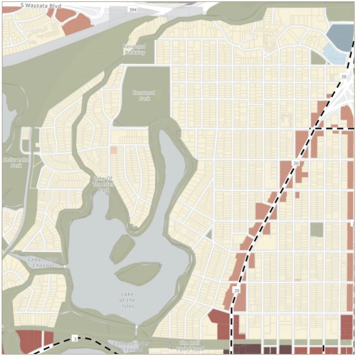
Kenwood, Lowry Hill and East Isles are some of the best-preserved, well-designed late 19thand early 20th-century neighborhoods in the entire country.
Among the area’s many assets are its history, unique housing stock and green space. These are amenities not only for those who live nearby but also for the tens of thousands who enjoy walking, biking or driving throughout these picturesque streets on their way to work or on a Sunday afternoon on their way to Lake of the Isles or other places.
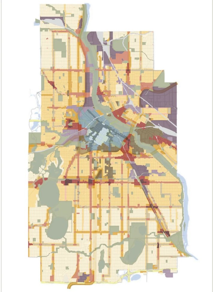
The new zoning map is a shockingly blunt instrument, little more than a mechanically drawn series of concentric circles (actually, squares) radiating from the downtown core with almost no variation, other than some areas of even higher density housing. From 36th Street in the south to Lowry Avenue in the north, virtually the entire area outside the downtown core is zoned UN2 (or “Urban Neighborhood 2”), presumptively allowing fourplexes and up. This is true in our area, Bryn Mawr, Near North, Northeast and the southeastern neighborhoods.
This plan is not a catalyst for more affordable housing.
To allow such across-the-board development without any additional, meaningful consideration risks turning the whole city into a wild west for developers, creating strong financial incentives to tear down existing structures to build high-profit, high-density housing, without any regard to tax base implications, quality of living or the carbon cost of demolition and rebuilding. And given the underlying land costs alone, there is virtually no chance that any such housing in our area would come close to meeting the affordability goals that are ostensibly driving this process.
To solve the housing crisis, the people of Minneapolis deserve a plan that is more nuanced than big squares arbitrarily imposed on a map. Special care and resources should be given to areas where major demographic changes are taking place, and where residents are crying out for development that will improve — rather than threaten — their neighborhoods.
Consider downtown Minneapolis, for example. It is in crisis, and without a vibrant downtown core we won’t have much of a city. Returning office workers aren’t going to save it, because they’re not all returning, which leaves housing to fill in the gap. Our housing situation could be substantially transformed just by converting surface parking lots and offices to residential units. There is more than enough space to effectively expand housing without reducing our historic residential neighborhoods to dense, homogenous blocks.
Local planners know how to protect historic places.
Our city planners do know how to respect and protect historic areas with districts and incentives, but they simply aren’t doing it here. Out of 18 recognized historic districts in Minneapolis, planners selected only one for special overlay protection: the Harmon Place District.
That’s an ironic choice given the 2040 Plan’s unabashed hostility to cars; the only reason Harmon Place is celebrated as an historic district is that it was the automobile sales center of Minneapolis in the early 20th century. Don’t get us wrong, Harmon Place absolutely deserves historic protection, but so do many other areas in the city, and our planners’ apparent inability to see the city from any perspective other than a featureless aerial map threatens to let innumerable urban jewels slip through our grasp.
Let’s not repeat mistakes of the past.
Lest we forget, bright-eyed forces of urban renewal tore down the Metropolitan Building, leveled the Gateway District and destroyed vast swaths of downtown Minneapolis in the 1960s and ’70s. The experts then thought that they were accomplishing precisely what the experts now hope to achieve — a sweeping, centrally planned, equitable vision — but despite their best intentions, those efforts proved a crushing failure and are now regarded as civic vandalism on a grand scale. Minneapolis has a pattern of demolishing its way to the future but losing its history and producing less-than stellar results in the process.
Minneapolis deserves better. Our neighborhoods deserve better. During the original 2040 debate, we were sold triplexes that would blend with the overall scale and character of our neighborhoods, but in an astonishing bait-and-switch, the City is actually proposing to start dropping four-to-eight-plexes on us that will destroy what’s special about our unique city neighborhoods. Please write to our elected officials as soon as possible while the comment period is still open.
So, what can we do?
Several City officials have repeatedly indicated that the proposed zoning boundaries are essentially a done deal. But the zoning code is a living document that is frequently amended.
As of this writing, the new zoning plan is open for public comment only until February 26, 2023. More information from the City can be found at: https://minneapolis2040.com/implementation/land-use-rezoning-study/.
***Addendum:
This issue was first brought to the attention of Hill & Lake Press on Wednesday, February 8, 2023. Along with the release of the 2040 zoning map itself, the first question on the City’s public comment survey is: “Where should each of the UN districts (UN1, UN2, and UN3) be applied?” Hence this article.
On Saturday, February 11, just as this issue was going to press, we were put in contact with City planning staff, who said the survey question seeking public comment on the urban neighborhood boundaries was “misleading,” that the boundaries are more or less set, and that the public comment period is being extended by an additional 30 days.
Confused? You’re not alone. We will address these and other developments in an article in next month’s issue.